Archivo:Карпатский 05.jpg
From Wikimedia España
Jump to navigationJump to search
Size of this preview: 800 × 533 pixels. Other resolutions: 320 × 213 pixels | 640 × 427 pixels | 1,024 × 682 pixels | 1,280 × 853 pixels | 4,000 × 2,666 pixels.
Original file (4,000 × 2,666 pixels, file size: 7.06 MB, MIME type: image/jpeg)
Summary
| Description |
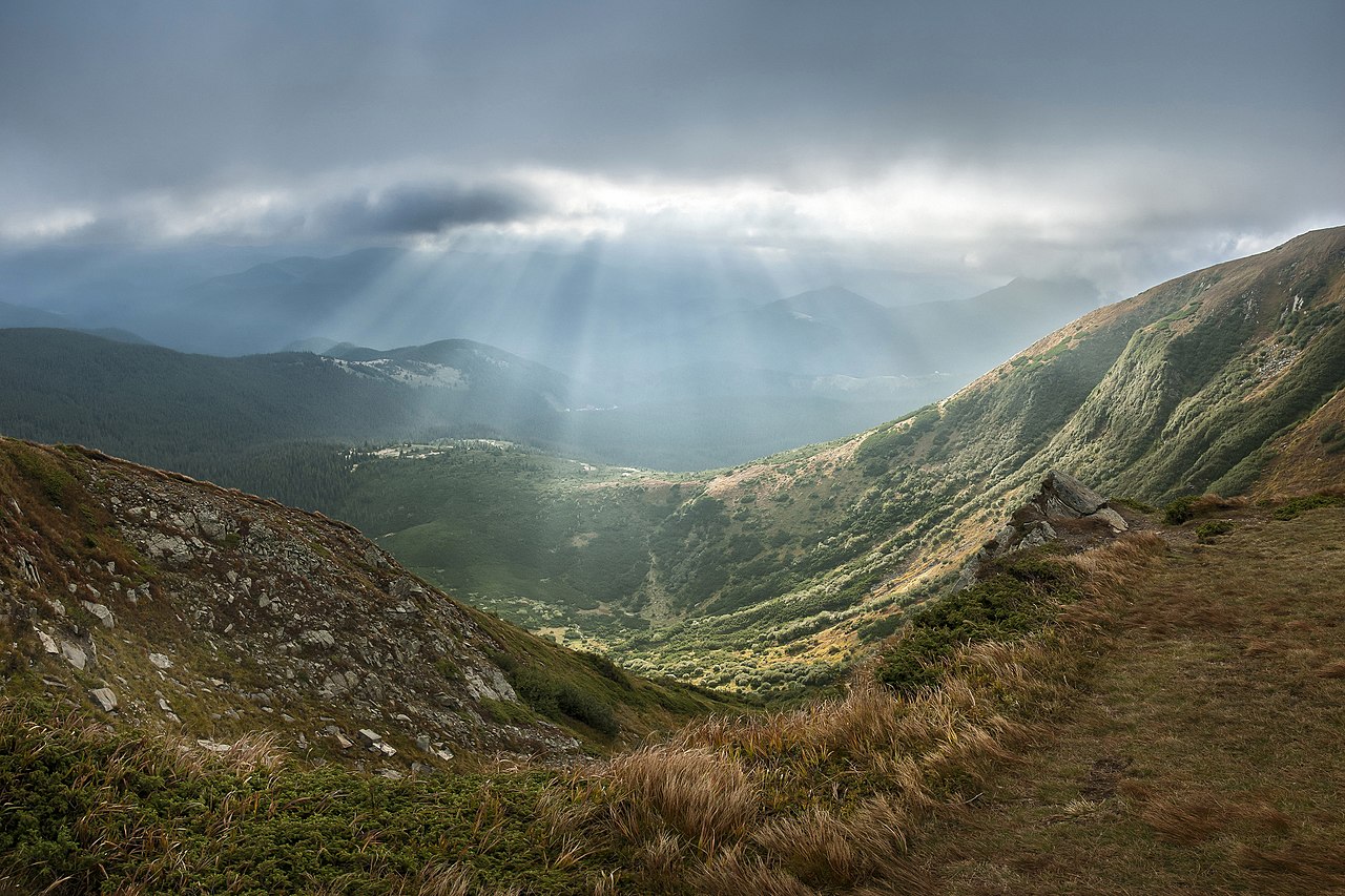
Čeština: Pohled na Karpatský národní park z hory Hoverla, nejvyššího bodu Ukrajiny.
English: View of Carpathian National Park from Hoverla. Carpathian National Park, Ivano-Frankivsk Oblast, Ukraine
Español: Parque Nacional de los Cárpatos, ubicado en el monte Goverla. Ivano-Frankivsk Oblast, Ucrania.
Français : Vue du parc naturel national des Carpates depuis le mont Hoverla, la plus haute montagne d'Ukraine.
Polski: Widok z Howerli na Karpacki Park Narodowy. Karpacki Park Narodowy, Obwód iwanofrankiwski
Русский: Вид на Карпатский национальный парк с горы Говерлы. Карпатский национальный природный парк, Ивано-Франковская область Украины
Українська: Вид з Говерли на північний схил г. Брескул у Карпатському національному парку, Івано-Франківська область
Português: Parque Nacional dos Cárpatos, localizado na montanha Hoverla, o ponto mais alto da Ucrânia.
Bosanski: Panorama Nacionalnog parka Karpati, pogled iz Hoverla, oblast Ivano-Frankivsk, Ukrajina.
Magyar: A Kárpáti Nemzeti Természeti Park látképe a Hoverla felől Ukrajnában, az Ivano-frankivszki területen
한국어: 호베를라에서 바라본 카르파티아 국립 공원. 카르파티아 국립 공원은 우크라이나 이바노프란키우시크 주에 속한다.
Nederlands: Uitzicht over het Oekraïense Nationaal Park Karpaten vanaf Hoverla, de hoogste berg van dat land. |
| Date | |
| Source | Own work |
| Author | Balkhovitin |
| Other versions |
This image was uploaded as part of Wiki Loves Earth 2014.
|
 |
Licensing
I, the copyright holder of this work, hereby publish it under the following license:
This file is licensed under the Creative Commons Attribution-Share Alike 3.0 Unported license.
- You are free:
- to share – to copy, distribute and transmit the work
- to remix – to adapt the work
- Under the following conditions:
- attribution – You must give appropriate credit, provide a link to the license, and indicate if changes were made. You may do so in any reasonable manner, but not in any way that suggests the licensor endorses you or your use.
- share alike – If you remix, transform, or build upon the material, you must distribute your contributions under the same or compatible license as the original.
Assessment

|
This image won the 2nd prize in the national contest of Ukraine in Wiki Loves Earth 2014 Other languages:
|
|

This image was selected as picture of the day on Wikimedia Commons for 1 May 2015. It was captioned as follows: English: View of Carpathian National Park from Hoverla. Carpathian National Park, Ivano-Frankivsk Oblast, Ukraine. Other languages:
Bosanski: Panorama Nacionalnog parka Karpati, pogled iz Hoverla, oblast Ivano-Frankivsk, Ukrajina. Čeština: Pohled na část Karpatského národního parku z nejvyšší ukrajinské hory Hoverla, Ivanofrankivská oblast, Ukrajina. English: View of Carpathian National Park from Hoverla. Carpathian National Park, Ivano-Frankivsk Oblast, Ukraine. Magyar: A Kárpáti Nemzeti Természeti Park látképe a Hoverla felől Ukrajnában, az Ivano-frankivszki területen Nederlands: Uitzicht over het Oekraïense Nationaal Park Karpaten vanaf Hoverla, de hoogste berg van dat land. Português: Parque Nacional dos Cárpatos, localizado na montanha Hoverla, o ponto mais alto da Ucrânia. Українська: Вид на Карпатський національний парк з Говерли, Івано-Франківська область, Україна. 한국어: 호베를라에서 바라본 카르파티아 국립 공원. 카르파티아 국립 공원은 우크라이나 이바노프란키우시크 주에 속한다. |
This image was selected as picture of the day on Vietnamese Wikipedia.
|
File history
Click on a date/time to view the file as it appeared at that time.
| Date/Time | Thumbnail | Dimensions | User | Comment | |
|---|---|---|---|---|---|
| current | 07:26, 5 September 2014 | | 4,000 × 2,666 (7.06 MB) | Christian Ferrer | dustspots |
File usage
The following 9 pages use this file: